-
Day 1 Arrival in Kathmandu and transfer to hotel
Elevation:
N/A
Distance:
N/A
Time Taken:
N/A
Meals:
D
magine Nepal's Land-only package services begin with the evening meal. The hospitality continues as you are whisked away to your accommodation in Kathmandu and meet your fellow travelers at our welcoming dinner. Airport transfers are provided.
-
Day 2 Drive Kathmandu to Chhet Chhet, Trek to Simigaon
Elevation:
1997 m
Distance:
183 km
Time Taken:
11.5 hrs
Meals:
BLD
Today is the day you start your trekking adventure in Nepal. You will drive from Kathmandu around 5:30 AM towards Dhulikhel and continue to Chhet-Chhet via Dolakha. The total distance from Kathmandu is around 180 km, usually taking 8-9 hours.
From Chhet-Chhet, take the trekking trail on the right towards the suspension bridge. Just after crossing the bridge, the trekking trail begins a long and rapid zigzag ascent on the cemented stone steps and takes you to a small settlement called Simigaon. It usually takes 3 hours from Chhet Chhet to your lodge at Simigaon.
-
Day 3 Trek to Dongang
Elevation:
2817 m
Distance:
9.81 km
Time Taken:
6.5 hrs
Meals:
BLD
Today, we will be trekking from Simigaon to Dongang. The trail begins at the lodge and veers right, passing through the rhododendron forest. After half a kilometre, the trail climbs gently and drops down to the river bank, where you can see the suspension bridge that takes you to Riku village. Without crossing the bridge, continue on the right and continue your ascent to Surmuche, where you will stop for lunch. The trial is mostly zigzagged, wired stone steps. After a couple of uphill climbs, you will reach Kyalche, where only one lodge exists. From Kyalche, walk straight and descend to the village of Dongang, just beside Rolwaling Khola. Again there are only two lodges available here!
-
Day 4 Trek to Beding
Elevation:
3570 m
Distance:
10.42 km
Time Taken:
6 hrs
Meals:
BLD
Today's trek will take you through the Rolwaling Valley, home to some of the most beautiful scenery in Nepal. You'll start in Dongang at the confluence of two rivers—the Rolwaling Khola and the Tsho Rolpa. From there, you'll head upriver until you reach Thangdingma, where you'll stop for lunch at a teahouse. After lunch, your trek takes you further upriver, past Nyamare village, which was destroyed by an earthquake in 2015. The trail then follows a gentle climb from Nyamare to Changmi Kha Gateway, where you'll see giant trees that used to be part of a canopy forest before it was destroyed by logging. From Changmi Kha Gateway, it's just about 45 minutes until you reach Beding!
-
Day 5 Hike towards Dolma Khang BC, Overnight at Beding
Elevation:
3570 m
Distance:
6.83 km
Time Taken:
6 hrs
Meals:
BLD
Today we will retrace the trail toward Nyamare until you see the giant tree in the area and a Kani gateway. From there, take the narrow trail on the right towards the right side of the waterfall. Then, climbing sharply above the waterfall, follow the River towards the corner of the mountain where the Dolma Khang BC is located. The hike is about 6.83 km, taking 5-6 hours from Beding to Dolma Khang, BC and back to Beding.
-
Day 6 Trek to Naa Village & Hike to Dudh Kunda & Cho Rolpa Lake
Elevation:
4199 m
Distance:
6.43 km
Time Taken:
3 hrs
Meals:
BLD
Today is the most accessible day of the trek. You'll be hiking to Naa village from Beding, which will take about 3-4 hours and will have countless gentle switchbacks on the left side of a roaring Rolwaling Khola (also known as River) flowing from Cho-Rolpa Lake.
Along the way, you'll encounter prayer flags surrounding what is said to be the most significant rock in Rolwaling. And if you look uphill to your left, you'll see a painting of Guru Rimpoche painted on that rock.
-
Day 7 Trek to Yalung Basecamp
Elevation:
4984 m
Distance:
4.70 km
Time Taken:
4 hrs
Meals:
BLD
Today, we'll take a steep climb up to Yalung Basecamp. Along the way, we'll pass through Cho-Rolpa Lake and see the mountains of Rolwaling, including Cho-You and Pharchemo.
After crossing the box bridge from Naa Village, follow the trail on the right side of Rolwaling Khola that takes you to Cho-Rolpa Lake. From halfway, the steep ascent to Yalung Ri basecamp begins; it is a relentless climb, but the steep slope gets ever more scenic as you gain height, with the panoramic view of the mountains of Rolwaling, including Cho-You and Pharchemo. Finally, after 3-4 hours of steep climbing, you reach the small porter shelter built by IFMGA guides at Yalung Basecamp.
-
Day 8 Climb Yalung Ri (5630m) and trek to Grasslands Camp (4700m)
Elevation:
4700 m
Distance:
11 km
Time Taken:
9 hrs
Meals:
BLD
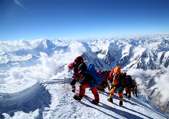
We will have a basic tea and porridge breakfast and a pre-dawn start from camp, setting off with the assistance of our head torch. The ascent of Yalung Ri is initially across scree and moraine, and we will take our time. After an hour and a half, as it starts to get appropriately light, we will reach the edge of the glacier on the mountain. Here, we will stop, take a break, fit our crampons to our boots, rope up for the straightforward ascent across an open snow slope and then an airy, but never too steep, snow ridge to the prayer-flagged summit—enjoyable climbing with fantastic views. We should reach the top by mid to late morning and return to base camp for lunch early afternoon. Then, we will descend steeply back to the Rolwaling Khola and the grassland camp.
-
Day 9 Trek to base camp on the Ripimo Glacier (5300m)
Elevation:
5300 m
Distance:
8 km
Time Taken:
7 hrs
Meals:
BLD
Today is a big day! We will be trekking up the west side of the Ripimo Glacier, a scant trail used only occasionally by shepherds from Na Gaon. Across the glacier's other side, the west face of Chobuche (6689m) rises impressively. After a short morning's walk, we'll reach the last of the ruined stone shelters at Drangnak, which overlooks the glacier. We'll have lunch here and then continue on our way. First, we'll head out onto the lateral moraine and then cross over onto the glacier. We make our way carefully across loose moraine material and patches of bare ice to a level area of scree and moraine, where we set up basecamp at an elevation of around 5300 meters. This is a fantastic situation with peaks on all sides, and we can see our objective, Khang Karpo (6646m), ahead of us.
-
Day 10 Rest and acclimatization at Khang Karpo Basecamp
Elevation:
N/A
Distance:
N/A
Time Taken:
N/A
Meals:
BLD
Today our guides and Sherpas will be going ahead to check out the approach to Khang Karpo. The peak has only been climbed once (as far as we know), and the conditions on the mountain will inevitably have changed since it climbed in late 2016. Meanwhile, the group will rest and acclimate at the base camp. Today is also an opportunity to check climbing gear before moving into ice and snow tomorrow.
-
Day 11 Climb up to our high camp at 5700 meters
Elevation:
5700 m
Distance:
3 km
Time Taken:
4 hrs
Meals:
BLD
Today is a scenic and challenging day as we make our way over the Ripimo Glacier and onto a tributary glacier that joins it from the east. We rope up for this short ascent, which is technically straightforward but crevasse-laden. Once we reach our base camp, we have lunch and drink lots of water before settling for an early night. The Sherpas take advantage of the afternoon to fix a line up to the summit ridge on Khang Karpo itself.
-
Day 12 Summit Khang Karpo (6646m) and descend to High Camp
Elevation:
5700 m
Distance:
5 km
Time Taken:
15 hrs
Meals:
BLD
This day will be one of the most memorable of your life. We'll get a very early start and begin our trek up the mountain, roped up and following the guides.
You can watch as we ascend a steep couloir to reach the low point on the ridge between Khang Karpo and Rolwaling Kang. Once we're established on the ridge, there's still a long way to go. Khang Karpo's north ridge is never too technical, but there are short steep sections to overcome, and the first ascensionists reported that there were several snow bridges to negotiate. It's likely to take us 8 or 9 hours to reach the summit.
This is one of the finest viewpoints imaginable, with views of at least six of Nepal's 8000-meter peaks—Everest, Makalu and Cho Oyu. Returning by the same route, we will aim to return to camp before dark!
-
Day 13 An extra or contingency day
Elevation:
N/A
Distance:
N/A
Time Taken:
N/A
Meals:
BLD
We have built an extra day in case we lose time during the first part of the trip or as a contingency against poor weather on the scheduled summit day.
-
Day 14 Descend to the Ripimo Glacier and cross it to Glacier Camp (5000m)
Elevation:
4900 m
Distance:
7 km
Time Taken:
5 hrs
Meals:
BLD
Today we will descend the Ripimo Glacier and cross it to Glacier Camp (5000m). This camping place is pretty close, 'as the crow flies', but we have some reasonably complicated terrain to cross on the way, and we will rope up again before setting off into the valley. We pass the site of our base camp at 5300 meters and continue across the rubble of the Ripimo Glacier to reach the relative comfort of our off-glacier campsite. We will aim to get to camp in time for a late lunch and leave the afternoon free as a contingency in case we've been held up during the morning trek.
-
Day 15 Trek back to Na Gaon (4280m) in the Rolwaling Valley
Elevation:
4280 m
Distance:
10 km
Time Taken:
5 hrs
Meals:
BLD
It's a beautiful day, and we're not in a rush as we head out along the pleasant ablation valley trail above the glacier. We pass through rough pasture areas with lots of pretty wildflowers and pay our respects again as we pass the shrines at Dudh Pokhari. We are now so well acclimatised that the trekking feels almost effortless as we reach the Rolwaling Valley and continue losing height. Finally, we should get our lodge accommodation in Na Gaon for a late lunch. Afternoon free!
-
Day 16 Trek via Beding to Dongang
Elevation:
N/A
Distance:
N/A
Time Taken:
N/A
Meals:
BLD
Today we will be trekking from Beding to Dongang (2800m). Today is more extended than usual regarding distance covered, but the trekking is easy downhill along the Rolwaling Khola. After a couple of leisurely hours, we reach Beding and continue for another 2-3 kilometres. We pass through several hamlets and isolated farms along the way. The route stays on the north side of the river until just before Thangdingma, when it crosses to the south side. We may stop for lunch at Thangdingma before returning to complete our day's walk to Dongang.
-
Day 17 Trek to Simigaon
Elevation:
N/A
Distance:
N/A
Time Taken:
N/A
Meals:
BLD
We begin by skirting above the Rolwaling Khola, passing the isolated lodge at Kalche, and descending via several long sections of stone steps towards Simigaon.
-
Day 18 Trek to Chetchet and drive to Kathmandu
Elevation:
N/A
Distance:
N/A
Time Taken:
N/A
Meals:
BLD
From Simigaon, we descend to the bridge over the Tama Kosi River and cross it. Then, we continue to Chetchet, where we'll board our vehicle for our 8-hour journey back to Kathmandu. We arrive in Kathmandu by late afternoon.
-
Day 19 Final Departure
Elevation:
N/A
Distance:
N/A
Time Taken:
N/A
Meals:
B
At the end of your program, we will arrange for transportation to the airport, and your guide will go to see you off. Flight check-in times vary based on the airline but are typically three hours before flight time.